 This is the view across the valley from above that road.
 The warning for the road -they were very serious and the sign was very accurate.
 Looking at the road from the side part way down the mountain.
 This is one of the boulders that threatens the road from above.
 Looking back across the valley once we were down.
 The mountains look like an Indian blanket with the different colors and designs.
 This rock is the reason the town is called Mexican Hat.
 We found this old suspension bridge on the way to Cisco. It has not bottom to the bridge so no driving or walking on it.
 It was a good thing we dd not plan on staying or eating in Cisco. Turns out it is pretty much abandoned.
 This was the old Post Office for the now defunct town. There were a few people there and a small store but not much else.
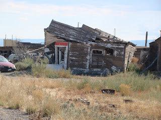
 One of the typical houses and cars left in the town.
 A look across the town or at least part of it.
We stopped to see some Petroglyphs near the Colorado River. This is the whole rock they were on.
 This is a tree ladder in the crack of the rock that the early people used to get to the top of the rock in the above photo.
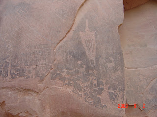
 Finally here are the Petroglyphs.
 Some of the people along the river have built their homes right into the rock.
 Here is a garage that was built into the rock. We also saw the use these type garages for horses.
No comments:
Post a Comment