This and the photo below were miniatures we saw on one of the lakes as we were exploring the countryside.
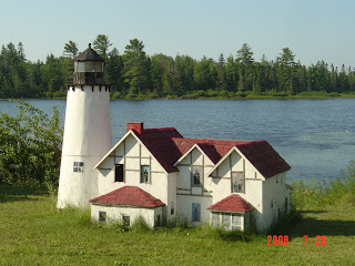
the miniature ship setting on one of the lakes.
This is a war memorial to the Indians that served and will serve in wars.
One of our side trips, better known by some as "this is where we are going to die". The only way out was the way we came in.
This is the Whitefish lighthouse.
this sign is in the museum for the Whitefish lighthouse, the lens is seen below and is huge.
Point Iroquois lighthouse.
Point Iroquois light house has one of the best grounds we have seen. Flowers all around the fence area and little gardens within the fence.
from the side to show the flowers along the fence.
a spade shaped flower bed and below is a heart shaped flowerbed as seen from the top of the lighthouse.
this is a view from the top of the lighthouse across the waters of Lake Michigan.
The Mackinaw bridge across Lake Michigan
Mackinaw lighthouse now used as a museum.
sign for the shipwrecks of the Mackinaw Straits
one of the boat rides you can take on Lake Michigan - it throws water for effect.
this is tree trunk that is being carve int a statue where it stood.
Thursday, July 31, 2008
Sault Ste Marie MI and surrounding areas
Castle rock from across the freeway.
Castle rock as we stood at the bottom looking to where we were going to climb.
Part way up the 125 stairs to get to the top.
After a short inclined walk to the platform (& the 125 stairs) Bil made it with his tongue hanging out. ha ha
A view across the valley from the top.
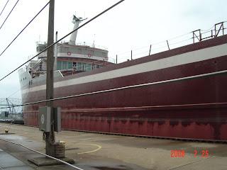
Th locks at Sault Ste Marie Mi. this is the Saginaw as it goes through the lock.Approaching the lock area.
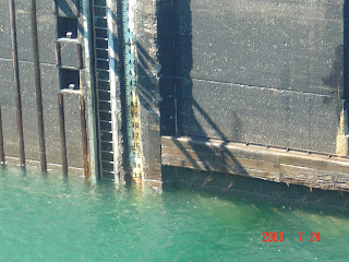
The depth of the water when it entered was 54 ft down.
This shows the lock and gates as it is filling for it to pass through.
This is the water at 33 ft when they are ready to open the gates and let it continue passage.
This is how the ship looks as to height when it leaves the locks. Notice how much more of the ship can be seen above water than in the first photo.
Tuesday, July 29, 2008
Marquette and surrounding area
this is the only petunia tree I have ever seen. It is art, as the tree trunk is phony and the branches are actually potted plants made to look like a tree.
this is at the entrance to another campground in the area. It is a little island and has a water wheel as seen in the next photo.
one of the light houses we saw. this one is the Marquette light house.
This one is also in Marquette but is called the Presque Isle lighthouse.
the town of Marquette has flowers down all streets and businesses in the downtown area. It is really beautiful to see.double click and enjoy them.
the campground we stayed at had numerous stone sculptures by this gentleman, see below.
wakefield mi boat ride
Indian face rock - it actually has 2 faces one higher up.
across the water as we were taking the Picture rock boat ride
Arch rock is one of the many formations made by the wine and water in the sandstone.
this is one of the overlooks at castle rock another formation.
you can really see the color in these rocks. It is caused by the manganese, copper and all the other minerals in the soil and rocks.
this is East Channel lighthouse on one of the islands.
Double click this one to see the root connecting the tree on the stand alone rock to those on the mainland. That is it's only source of nourishment.
Friday, July 25, 2008
MI copper point ski & waterfalls visited
The sign with all the stats for the ski jump. This is near Wakefield Michigan.
The ski jump as viewed from below.
This is the top of the ski jump. It is 1782 ft above sea level and nearly 1200 ft above lake Superior. It was foggy on the lake so we could not see it from the top. The very top is where we went to see 2500 sq ft across Michigan, Wisconsin, Minnesota/Canadian border.
The ride up was an 800 ft chair lift then the 18 story elevator ride and the 8 story climb.
This is a view of the trees and flowers we saw on the way up. Double click to see the pretty flowers.
Boy don't I look small compared to the jump and the trip we are about to take. This is the base of the elevator.
Still going to the top. It was an 18 story ride in the elevator then an 8 story walk the rest of the way to the top.
This view is down the slope. Done by experts they actually can fly 600 ft before hitting the ground to ski. In competition the skiers can get up to 70 mph.
A view from the top over the forest.
A view from the backside as we were going home.
Following are just a few of the waterfalls we have seen around the Wakefield MI area. This area has the highest concentration of waterfalls in the states.
This is an exposed root system of a tree along our path to the falls.
This is one of the paths taken to get to the waterfalls. It was really a beautiful area.
Subscribe to:
Posts (Atom)